GEOGRAPHY :
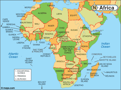
Algeria is the largest country in Africa, it is bordered to the north by the Mediterranean Sea, to the east by Tunisia and Libya, to the south by Niger and Mali, to the south-west by Mauritania and Western Sahara and, to the west by Morocco.
Algeria is composed of four principal sets of landforms:
To the north, along the Mediterranean coast, the narrow plain extends from Algerian Tell.Limiting the coastal plain to the south, a vast whole of higher reliefs is observed: two significant East-West directed assembly lines (the Tell Atlas in the north, the Saharan Atlas and the Aurès in the south) frame an area of the desert high lands.
To the south of the Saharan Atlas the immense desert extends from the Sahara which accounts for 80% of the surface of Algeria. The Sahara is composed for a great part of rock lands and stony plains. Two vast sand areas (Large Western Erg and Large Eastern Erg) constitute the principal sets of the Saharan desert.
Lastly, to the south of the Sahara extends the solid Hoggar massif. It is a succession of the desert highlands which rise in steps, dominated in its central part by imposing reliefs with a notched profile, which culminate to 2 908 m in the north of Tamanrasset (the highest peak : Tahat 3 003m).
CLIMATE
The north is characterized by a Mediterranean climate, with hot and dry summers and mild and rainy winters. The average temperatures in summer and winter are respectively of 26 °C and 11 °C.
The more one goes down towards the south, the more the climate becomes dry: annual precipitations in the highlands and the Saharan Atlas do not exceed 200 to 400 mm.
The Sahara is a windy and very arid area, where the thermal amplitudes are often considerable: these variations in temperatures, extremely high the day and very low the night, are explained by the total absence of a humidity capable of attenuating contrasts.
The height of the annual rains is less than 130 mm in the whole of the Algerian desert.
HISTORY :
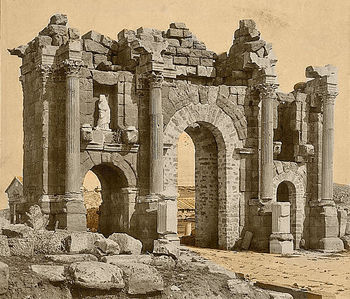
Historically, Algeria was first known as the Kingdom of Numidia whose most famous Kings were Syphax, Massinissa and Jugurta who ruled the Kingdom during the III and the II century BJC.


Massinissa, founder
of the Numidian kingdom
(201 B. J.-C.)
⦁ Numidia became Roman province in 46 BJC after a war between Jugurta and the romans.
⦁ The Vandals invaded the roman North Africa 430 before the byzantyne conquest in 533.
⦁ The byzantyne era finished with the arrival of Islam and the Arabs in 647.
⦁ Many Muslim dynasties ruled the country from 776 to 1518,
⦁ the Rostomides (776 to 909),
⦁ the Fatimides (908 to 972)
⦁ the Zirides (972 to 1148),
⦁ the Hammadites (1007 to 1152)
⦁ the Almoravides(1052 to 1147 )
⦁ the Almohades (1121 to 1235),
⦁ the Zianides (1235 to 1556).
⦁ The Ottoman era started in 1518 when the Algiers was placed under the Ottoman authority. Algiers was then a recognized authority in the western Mediterranean and had established a huge naval fleet led by Aroudj and Kheireddine Barbarous.


⦁ Algiers has resisted many European offensives by the French, Spanish and English
⦁ In 1830 the French succeeded in their attempt to occupy the country.
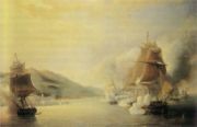
Attack of Algiers by Amiral Dupperé, 13th june 1830
Struggles against colonialism from great national heroes has continued till after 1880 in different parts of the country by leaders like: Emir Abdelkader, Cheikh El Mokrani, Cheikh Bouamama, Boumaaza and Lla Fatma N’Soumer, and others…
France stayed in Algeria from 1830 to 1962. In 1954, after strenuous efforts, the Algerian people started the great Liberation war against the French which ended in 1962.
The independence has been obtained after one million and half martyrs and a huge sacrifice from the Algerian people.
On July 5, 1962, Algeria proclaimed its independence.
QUICK FACTS ABOUT ALGERIA:
Formal name: People’s Democratic Republic of Algeria
Capital: Algiers
National Holiday (National Liberation War outbreak): November 1.
In addition, Algeria celebrates Independence and Youth Day on July 5 every year.
Official languages: Arabic and Tamazight
Official currency: Algerian Dinar (DZ)
Member of regionals organisations :
– OAU (Organization of African Unity) / AU (African Union): member since 25/05/1963.
– The Arab Maghreb Union (AMU): Following a meeting on 10 June 1988 in Zéralda, Algeria, the five Heads of State of the Arab Maghreb signed a treaty establishing the Arab Maghreb Union on 17 February 1989 in Marrakech.
State institutions
President: Abdelmadjid TEBBOUNE (elected on 19/12/2019)
Prime Minister : Aimene BENABDERRAHMANE
Minister of Foreign Affairs and National Community Abroad: Ramtane LAMAMRA.
Algerian Parliament: – Upper house: Council of the Nation
– Lower house: People’s National Assembly
Main cities: Oran, Constantine, Annaba, Ghardaia, Tlemcen, Ouargla, Setif, Béjaïa, Mostaganem, Tizi Ouzou, Biskra.
Administrative organisation: The President of the Republic, Mr. Abdelmadjid TEBBOUNE, decided, on 21 February 2021, to promote ten (10) administrative districts from the South to Wilayas. They are Timimoune, Bordj Badji Mokhtar, Beni Abbes, Ouled Djellal, In Salah, In Guezzam, Touggourt, Djanet, El M’Ghair, El Menia. With this new division, Algeria now has 58 Wilayas.
Geographic data:
Area: 2 381 741 km2.
Population: 43 053 054 (estimation 2019/ World Bank).
Demographic data:
Urban population: 73, 73 (World Bank 2020)
Life expectancy at birth: 76, 88
Median age: 29 years (2020)
Religion: Islam
Human Development Index: 0, 53 (Human Capital Index 2020/ World Bank).
Natural resources: Petroleum – natural gas – iron – phosphates – uranium – lead –zinc – gold…
Working hours and days:
Working hours: 8:00 a.m. to 4:30 p.m.
Working days: Sunday to Thursday
Public holidays:
National holidays:
⦁ Independence Day (July 5)
⦁ National Liberation War outbreak day (November 1).
Civil Holidays:
⦁ Worker’s Day (May 1)
⦁ New Year’s Day (January 1)
⦁ Yennayer New Year’s Day (January 12)
Religious Holidays:
⦁ Aïd-El-Fitr (2 days)
⦁ Aïd-El-Adha (2 days)
⦁ Awwal Mouharram
⦁ Achoura
⦁ El-Mawlid En-Nabaoui